36
/ BUILDING DIALOGUE / DECEMBER 2015
Harness Technology for Site Development
A
ccording to Pew Research Center, 10,000
members of the baby boomer generation
will retire every day for the next 19 years.
This major shift in generational majority in the
workplace is catalyzing a necessity for an accom-
panying, evolutionary shift in the way we work
in the land development and building industries.
Growing numbers of millennials and members
of Generation X beginning to lead and manage
translates into a core focus on the demand for har-
nessing new and innovative technology in every-
day practices. With the addition of this innovative,
modern technology and a fresh look at the develop-
ment process, we can revolutionize the way we build
communities.
To harness this new technology and reap its gen-
erous benefits, planning is paramount. Planning
early in the process is an even more preeminent
condition.
Generally, the greatest roadblock in the planning,
designing and building process comes from the
breakdown of communication. In a society increas-
ingly demanding of instantaneous communication,
the need to share information in a timely way can
no longer be ignored. Working with a clear under-
standing of what needs to be done saves time, saves
money, and keeps mistakes at a minimum.
Smartphones, tablets and email are the founda-
tion of communication in our fast-paced industry.
While these tools are efficient, the next step is to im-
prove the accuracy of the information exchanged –
develop better archival methods, add a spatial com-
ponent to our conversations and make it easier to
retrieve information.
Vertical construction has embraced building in-
formation modeling because it helps visualize con-
flicts in a virtual environment before building. This
building block of industry technology is an elec-
tronic data model that is populated with all kinds
of information that can be used to track materials,
costs, warranty, schedules and more.
Land development has the ability to harness
geographic information systems as a means of vi-
sualizing all things outside the building envelope.
Engineers and landscape architects prototype a
site in an electronic environment – the same data
model already exists before a single yard of dirt is
even moved. Computer-aided design data can be
migrated to GIS where the three-dimensional data
can be tagged with limitless information. The more
robust the model, the more detailed the queries can
become. Essentially, with this new technology, the
same projections can be done with a GIS model as
can be done with a BIM model.
Making this information accessible has been the
greatest challenge to its use. Google Earth is some-
thing many of us use for directions or to find more
information about a location. So the question now
stands, how can our industry benefit from some-
thing as simple as this everyday technology?
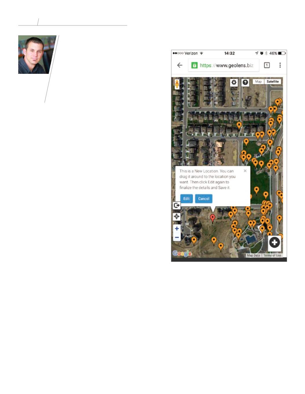
We partner with and endorse GeoLens, a software
group that takes this data model and presents it in
a user-friendly web application, functionally trans-
forming it into exceptional technology. GeoLens
also offers various tools for teams to collaborate and
share information, and associate this information
with items on a map of the project.
GeoLens technology allows users to add informa-
tion and modify information, and do this in real
time without any GIS or BIM training. This technol-
ogy is specifically designed to function in a mobile
platform and eliminate the need for paper. By using
a system like GeoLens, construction teams can link
the office and field instantly. Conversations can now
include a diagram spatially linked to information in
the cloud.
The technology doesn’t stop there. The cool factor
comes fromgroups like Siemens Technologies, which
Josh Orth
Landscape
Architect,
Norris
Design
TRENDS
in Land Planning Technology
A screenshot of GeoLens


